The Center for Safety Equity has conducted many projects to improve the safety condition of rural, isolated, tribal, and indigenous communities. There is a severe equity issue in these communities, as one is significantly more likely to be injured or killed in a traffic collision than in urban areas. Further, Native Americans are also more likely to be killed or injured in traffic collisions than caucasians. These issues compound, as many tribal reservations and lands are in rural areas. These projects address this critical disparity by targeting the unique circumstances that precipitate these collisions. The UW STAR Lab has partnered with several tribal nations in the state of Washington to target the unique safety issues faced by the tribal communities. We have partnered with the Confederated Tribes of Colville to develop a safety data collision database to collect, store and utilize the collision records for the reservation. This has allowed safety engineers to better understand the causes behind collisions and to develop countermeasures to address these collisions. Similarly, we have partnered several times with the Yakama Nation to further develop this safety technology. Building off the safety database developed for the Confederated Tribes of Colville, we have developed a safety data visualization and analysis tool (pictured), which allows the tribe to both visualize where collisions are happening on their road network and to analyze those crashes to extract the most dangerous sections of roadway that need the most attention. We have also found through our work with the tribes that the volume, quality, and accessibility of data is lacking. To address this, we have partnered with Yakama Nation to pilot a sensor installment, the MUST Sensor, to collect critical safety data including vehicle counts, vehicle speeds, pedestrian counts, bicycle counts, roadway surface conditions, as well as weather conditions. These new data sources will be useful to identify the safety concerns faced by the community and to begin to implement safety countermeasures to address these issues and reduce roadway fatalities.
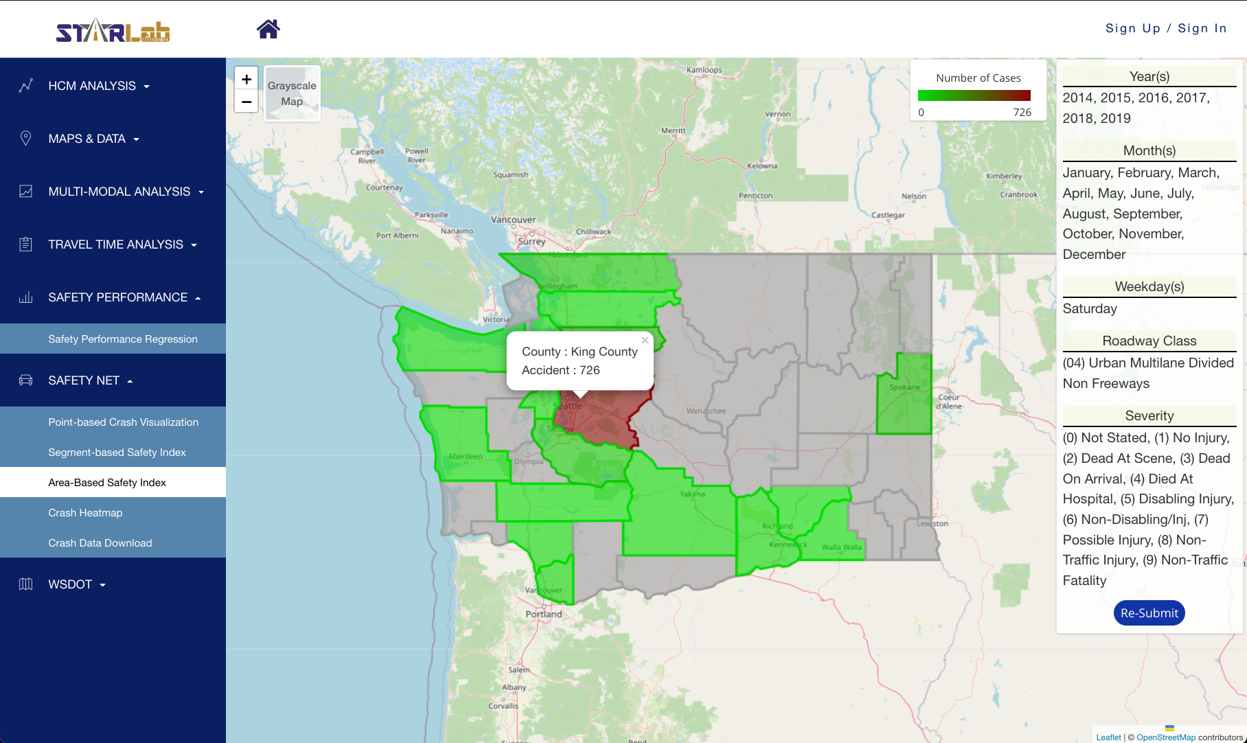
Figure 1. Safety Net for crash visualization on three aggregation levels: point-based, segment-based, and area-based.
Related Publication
Wang, Y., Sun, W., Ricord, S., Souza, C. M. D., Yin, S., & Tsai, M. J. (2021). Developing a Data-Driven Safety Assessment Framework for RITI Communities in Washington State [2021] (No. INE/CSET 21.09). University of Alaska Fairbanks. Center for Safety Equity in Transportation (CSET).